Beaucatcher Tunnel

For over a year, the North Carolina Department of Transportation worked on weekends and at night to restore and clean Beaucatcher Tunnel in Asheville - one of the state's most treasured landmarks.  The $1.5 million renovation including the installation of beautiful new rock faces at both entrances, coating the interior with a graffiti-proof coating and stopping water leaks inside the tunnel

In addition, the Department made the tunnel safer for pedestrians by replacing fences with concrete barriers and constructing sidewalks.  Started in 1927 and completed in 1929, the tunnel serves as a major link to downtown Asheville as part of U.S. 70/74 and I-240.  With the renovation, more travelers can enjoy the natural beauty of this facility.

ASCE NC Web Director
Old Salem Pedestrian Bridge

Winston-Salem, North Carolina

Constructed in 1998 (sketch) as a project by NCDOT, the Old Salem Pedestrian Bridge provides a pedestrian overpass over the Old Salem Bypass (Highway 52) at Old Salem, site of North Carolina's first Moravian community.  The structure is located approximately mid-block between Walnut Street and Salem Avenue, adjacent to, and immediately south of the new extension of the Museum of Early Southern Decorative Arts.  Old Salem, the restored 18th Century Moravian Museum Village, is a historic district which is included in the National Register of Historic Places as a National Historic Landmark.

The Old Salem pedestrian bridge is a timber Burr arch truss bridge (named for early 19th Century American bridge builder Theodore Burr) which compliments the characteristics of Old Salem's Moravian heritage.  The structure spans approximately 120' over Old Salem Bypass with 17' vertical clearance over the roadway, and a 12' walkway.  The bridge is framed with two massive Burr-arch trusses, 15'-10" in height with a 5' rise.  The arches spring from two cast in place concrete, stone-faced abutments.  The western landing of the bridge has stairs and a wheelchair ramp, meeting the American with Disabilities Act requirements, providing access to the bridge from the strollway.  East of Old Salem bypass, the structure connects to an elevated concrete walkway leading to the stairwell and ramp, which connects to Main Street.

 
ASCE NC Web Director
Toxaway Falls Bridge

Transylvania, North Carolina

In the mountainous region of Transylvania County, a new bridge was built to replace a 1920s bridge that was very narrow.  The new bridge over Toxaway Falls was constructed to enhance the visibility of the falls and preserve the natural surroundings, including a massive exposed rock underneath the bridge.

To keep the earth from spilling into the massive granite bedrock, the North Carolina Department of Transportation constructed reinforced earth walls on both sides of U.S. 64.  In addition, the department tinted the base of the walls to match the color of the exposed rock.

To enhance visibility, metal bar rails were installed along the sides of the bridge - allowing people to get a breathtaking view of Toxaway Falls.  Cascading 240 feet down the granite face of the valley, the river is part of the winding Waterfall Scenic Byway along U.S. 64.

 
ASCE NC Web Director
Sneads Ferry Bridge

Bridge on NC172 over the New River

Sneads Ferry, North Carolina

Constructed in 1992 for approximately $13.2 million, the 2,781-foot long, high-level, fixed structure consists of 28 approach spans of Type IV, pre-stressed concrete AASHTO girders and 3 channel spans of Type VI, pre-stressed concrete AASHTO girders.  The channel span lengths are 137 feet, 140 feet and 137 feet.

The channel bents were designed to AASHTO specifications for vessel impact forces and are supported by 54-inch diameter, precast, pre-stressed concrete cylinder piles.  Vertical clearance over the navigational channel is 65 feet.  Lighting on the bridge for both vessels and aircraft are powered by an array of solar panels and a battery bank.

 
ASCE NC Web Director
Sixth Street Bridge

North Sixth Street over the railroad tracks 1910-11, Wilmington, North Carolina

Project By:  Des Moines Bridge & Iron Company

This truss bridge is not only an excellent example of its type, but is the only such bridge that survives in Wilmington.  Constructed in 1910-11, the bridge was jointly built by the Atlantic Coast Line Railroad and the City of Wilmington.  A thru-bridge on two concrete abutments, it is 145 feet long and 45 feet wide.  Bill Reaves's column in the Star-News of August 22, 1976, gives the best history of the bridge.

The Sixth Street Bridge was originally constructed to join a city divided.  For many years the northern section of the city remained undeveloped, largely due to the Wilmington & Weldon Railroad tracks which divided the city, north from south.  The first bridge was of wood, built about 1873.  The Wilmington Board of Aldermen ordered the railroad company to construct bridges across the "cut" at Second, Third, Fifth, Sixth, Seventh and McRae streets.  At this time only one bridge existed and it was located on Fourth Street and was called the Boney Bridge, but it was considered too narrow for heavy traffic.  The bridge on Sixth Street was to be 25 feet wide.  In 1866, the Sixth Street Bridge was condemned and a new bridge was built, again of wood.  This bridge was rebuilt again in 1891 and 1895.  In 1902, the Wilmington Dispatch newspaper reported that "the old wooden bridge over the Coast Line tracks at Sixth street is to be repaired and a contract will be let in about ten days.  The bridges will be kept in good repair and when the Fifth Street bridge is finished there will be three "first-class" bridges connecting Brooklyn (the section of the city north of the tracks)."

In December, 1909, the wooden bridge was condemned and removed.  The same month, negotiations began for a new bridge constructed of steel with wood floor.  In July 1910, an advertisement for bids for a steel bridge at Sixth Street appeared in newspapers.  The bids were opened in August 1910, and a contract was let in September.  The bid accepted was made by the Southern Construction Company of Burlington, N.C.  Its proposal was $7,500.

The contract made with is company proved to be a disaster.  From the beginning they had trouble making the required bond and in May 1911, the contractor left town, leaving many of his laborers with wages unpaid.  The construction firm also left unpaid bills, among which was a large one with the Des Moines Bridge & Iron Company who supplied the steel for the bridge.  The sheriff attached the unfinished bridge and all the materials yet to be used.  The press referred to this situation as the "Sixth Street Muddle".

One June 17, 1911, it was announced that A.D. O'Brien, a Wilmington Civil Engineer, had been awarded the contract to complete the bridge on Sixth Street.  His bid was $1,400.  The bridge was completed in the fall of that year and dedicated."

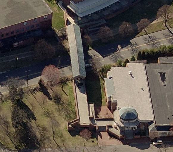
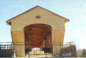
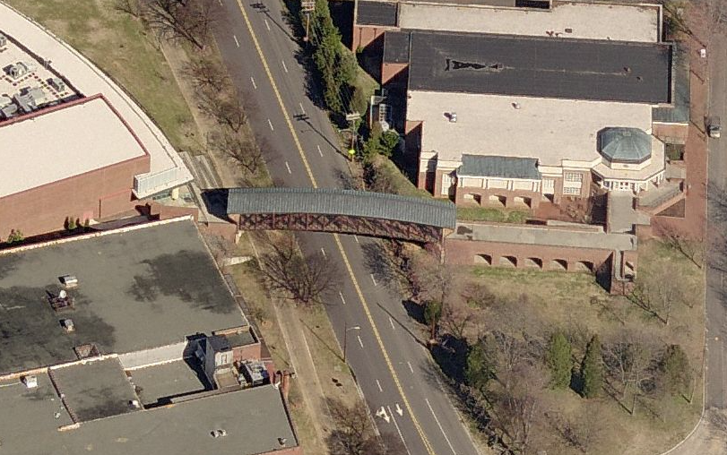
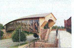
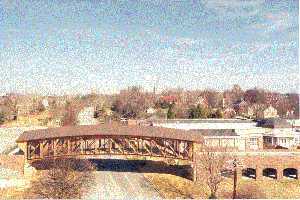
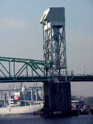
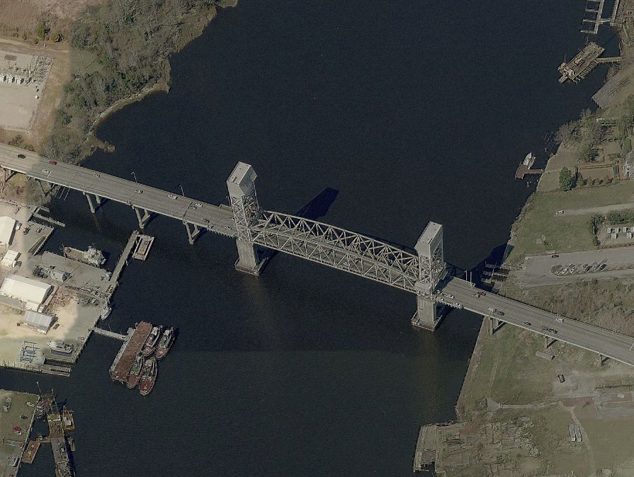
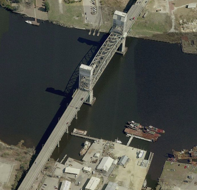
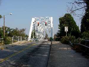
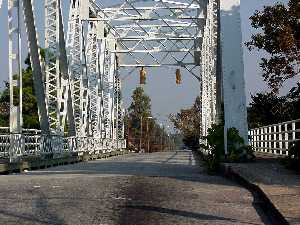
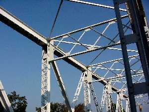
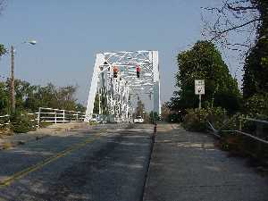
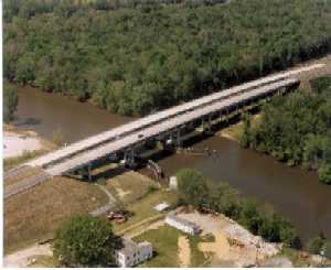
Included in the national Historic American Engineering Record, the bridge has been photographed and recorded for permanent record.  Its inclusion attests to its value as an example of the style and to its relative rareness as an area survivor.  At one time, all Wilmington streets crossed the railroad tracks on truss bridges of one type or another.  This bridge along survives.

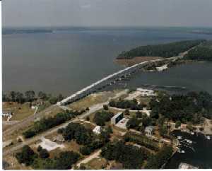
The narrowness of the bridge and ramp approaches, which highway engineers are fond of listing as two of its major drawbacks, may also be viewed as part of the value and charm of such bridges.  They force us to slow down, and they remind us of the role the railroad played in the development of the area.  Vistas from this bridge not only show the deep cuts that the tracks made through Wilmington, but the many commercial and industrial structures along the right-of-way, all railway-oriented.  To the northwest, dwelling along the tracks are also visible.

 
ASCE NC Web Director
Roanoke River Bridge

Bridge on US 13-17 over the Roanoke River, Williamston, North Carolina

The dual structures carry a four-lane facility over the Roanoke River, replacing an existing two-lane, low-level swing-span bridge.  Construction of this project was staged in order to maintain traffic during construction of the new structures as well as the demolition of the existing bridge.

The 915-foot long dual structures are supported by waterline footings bearing on precast, pre-stressed concrete driven piles.  The superstructure, spanning over the navigational waterway consists of three-span continuous steel plate girders with a 150-foot long center span.  Vertical clearance is 45 feet over the waterway to accommodate barge traffic on the river.

To protect the bridge from vessel collision, a bridge protection system consisting of timber wales and 24-inch diameter steel pipe piles is located adjacent to the channel piers.

The bridge was constructed in 1992 for approximately $3.5 million.  A solar powered battery bank provides electricity for the navigational lights on the dual structures.

 
ASCE NC Web Director
Neuse River Bridge

Opened to traffic in November 1999, the US17/NC55 crossing of the Trent and Neuse Rivers was North Carolina's largest single-contract highway project to-date.  The intricate system of roadway, ramps and bridges provides a highway functional by pass of historic New Bern.  The work was accomplished with special consideration to numerous environmental, social and historic issues.

The bridge in place prior to construction of this project was a narrow 2-lane, mile-long trestle bridge with a swing span at the main channel, comprised of steel beams and timber pile bents.  The bridge was in serious disrepair, and use of the swing-span caused traffic delays during the tourist season.

Roadway and bridge conceptual plans for the New Bern Bypass were finalized in 1992.  In late 1993, a project team, led by Ralph Whitehead & Associates (RWA) was selected to prepare construction documents for the Neuse River crossing.  The team led by RWA (also composed of DSAtlantic (Stantec), JMI Engineers, HNTB, Parsons Brinkerhoff, Barbara Mulkey Engineering, S&ME, and Nallmala-Hall-Wilson) completed roadway plans, bridge type studies, vessel collision analysis, plans for aircraft warning lighting system, signing, US Army Corps of Engineers permitting, load testing and hurricane storm surge modeling producing construction plans in May 1995.  The final design included eleven (11) bridges.

The 260' main channel span girder placements utilized the combined efforts of two 200-ton cranes, one 350-ton "ringer" crane and one 100-ton assist crane, all barge-mounted and all in tandem.

Bridge foundation work consisted of driving more than 1000 piles and installing more than 800 drilled shafts, utilizing steel casing and bentonite slurry for excavation support.  The drilled shafts averaged 100' in length, 25' of which was rock-socketed.  A sluggered schedule for footing/column/cap contruction resulted in the completion of all brdige bents or piers by summer 1998.

Fit-up was potential concern in light of the complex geometry for the fabrication fo the629 steel girders and more than 2000 diaphragms/cross-frames.

During construction, the New Bern area was battered by hurricanes Bertha, Bonnie, Fran, Dennis and Floyd the latter of which passed directly over the site on September 16, 1999.  Nonetheless, construction was completed approximately three months ahead of schedule.

Project Statistics:

49,000,000 pounds of steel
200,000 cubic yards reinforced concrete
221,000 feet (40 miles) pilings/drilled shaft/piers
8 miles bridge railing
​40,000 feet AASHTO precast girders

 
ASCE NC Web Director
Linn Cove Viaduct

Constructed 1978-83; opened 1987; Figg and Muller, Inc. (Tallahassee, FL), engineers; Jasper Construction Co. (Plymouth, Minn.), contractors; Rex Cocroft, Federal Highway Administration, chief supervising engineer, Blue Ridge Parkway on East Face of Grandfather Mountain.

The last link completed on the 469-mile-long scenic parkway that began in 1935 includes the viaduct an innovative 1,243-foot ribbon of concrete that gracefully skirts the side of Grandfather Mountain and rests on concrete piers built to minimize cuts into the slope.

Right-of-way acquired in 1939-40 ran along the base of the mountains, but in the 1950's a new parkway route was designed to cut across higher ridges of the mountain.  Hugh MacRae Morton, owner of Grandfather Mountain, refused to give up the land.  He fought the higher route "every way we could", arguing that cutting and blasting a road across Grandfather Mountain would be "like taking a switchblade to the Mona Lisa."  Morton's campaign delayed the project for more than 20 years.  After intervention by Governor Dan K. Moore, park service officials agreed to consider alternate routes and, with Morton, settled on a middle route.

By that time, engineering developments had emerged in Europe that allowed a revolutionary approach in which the road appears to float beside the mountain.  The structure literally and figuratively completes the original vision of the parkway in a marriage of aesthetics, environmental sensitivity, and spectacular engineering.  The roadway is composed of 153 pie shaped sections - no two the same shape, and only one straight - compressed into a continuous S-curve by internal tension cables.  It was built from south to north with precast segments progressively lowered in place by a stiff-leg crane.  The seven piers are set on microshaft piles drilled into rock - the only disturbance of the mountainside of massive boulders.  (A principal concern was to avoid methods that would destabilize the mountainside - a problem evident in landslides along other mountain highways, including I-40 in recent years.)

Although comparable structures had been built in Europe, this was the first of its type in the United States.  The French engineering firm of Figg and Muller was the only one in the world that had successfully used the techniques required.  The project was bid at $7.9 million, but final cost rose to $9.8 million.  The work crew was almost entirely from the Grandfather Mountain area.  Becoming a tourist attraction for its novel construction long before the other segments of the parkway were completed to permit its opening in 1987, the viaduct won national awards from the American Society of Civil Engineers and the Prestressed Concrete Institute.

From "A Guide to the Historic Architecture of Western North Carolina", Catherine W. Bishar, Michal T. Southern, & Jennifer F. Martin, 1999, The University of North Carolina Press, pp 226.

 
ASCE NC Web Director
Laurel Creek Bridge

Bridge on I-26 over Laurel Creek & SR 1318 in Madison County, North Carolina

Laurel Creek Bridge.jpeg

The four-lane structure will carry Interstate 26 traffic over a 250-foot deep gorge (Laurel Creek) in mountainous terrain between the City of Asheville, North Carolina and the North Carolina-Tennessee state line when completed.  The 970-foot long, 97-foot wide, five-span, continuous steel plate girder structure is to be supported by hammerhead-shaped, cast-in-place concrete piers as high as 210 feet.  The singlehollow shaft piers are designed for seismic forces per AASHTO Seismic Tall Performance Category B.

To protect the bridge piers, permanent top-down walls are located on the up-slope side to retain overburden material, including colluvium.

 
ASCE NC Web Director
I-485 & I-77 Charlotte Interchange
via Google Earth

via Google Earth

The new four-level interchange at I-485 and I-77 in Charlotte was designed to improve traffic flow through this congested area.  The interchange is part of the southwest Outer Loop around Charlotte.  To save costs on bridge construction, the North Carolina Department of Transportation used weathered steel and single span, pre-stressed concrete on the beams.  The upper bridge rises 90 feet above the existing terrain.  To retain the sloped earth around the interchange, reinforced earth walls were built along some parts of the interchange.

 
ASCE NC Web Director
Holden Beach Bridge

Bridge on NC 130 over the Intracoastal Waterway.

ee2360e2-9972-4f12-81e5-fb67433a5b83.jpg

The 1,800-foot long, high-level, fixed structure consists of 20 approach spans of Type III & IV prestressed concrete AASHTO girders and 3 channel spans of prestressed, precast box girders.  The channel span lengths are 86 feet, 117 feet and 100 feet.

This bridge structure features compound curvature in horizontal alignment in order to accommodate rigorous geometrical constraints imposed by Intracoastal Waterway vertical clearance and alignment on existing NC 130.  The vertical geometry consists of both crest and sag vertical curvature and varying superelevation.

Channel bents were designed with an integral fender system.

Acknowledgement:
Owner:            North Carolina Department of Transportation
​Engineer:            URS Corporation – Raleigh, NC

 
ASCE NC Web Director
Green River Bridge
trails-rodger11.jpg

When a four-inch crack was found in the main girder of the Green River Bridge on I-26, the North Carolina Department of Transportation devised an innovative rehabilitation plan that minimized construction cost and time.  To repair North Carolina's tallest bridge - which extends 235 feet above the Green River near Saluda - the department used high-strength bolts that reduced the stress in the girder.  Other retrofitting included removing the majority of the joints, using a new type of non-shrinking concrete (Type K), installing a new riding surface and protecting the steel girders from damaging de-icing salts.  When the bridge was completed in 1968, it was one of the first times that high strength welded steel girder construction was used in North Carolina.  Across the country, steel girder construction on bridges has caused problems.  The crack was discovered during a routine inspection.  After extensive testing and analysis, the steel was found to be of substandard quality.

 
ASCE NC Web Director
Bunker Hill Covered Bridge

Original bridge completed in 1895.  The construction is based on General Herman Haupt's patent for the Improved Lattice Bridge.  The Bunker Hill Covered Bridge is the only remaining example of Herman Haupt's 1839 patent for the Improved Lattice Bridge.  It is the oldest of only two remaining covered bridges in North Carolina and is on the National Register of Historic Places.  It is located approximately one mile east of a former stagecoach stop.

51681247.jpg

"The unusual Haupt Truss design was patented in 1839, and two modified examples are still standing.  General Haupt, a Pennsylvanian, was a noted bridge engineer and designer who graduated from West Point and became Chief of Military Railroads during the Civil War.  His patents show a panel-type truss using single-latticed diagonal braces, each spanning three short panels and also braced with a full-length kingpost, serving in place of an arch.  A number of bridges were built indifferent sections of the country, but only two remain.  One of these is in Thetford, VT, and has 4-foot panels.  A set of single outside braces each overlap two panel posts; there is an inside arch.  The other bridge, Bunker Hill Covered Bridge, is located in a park in Claremont, NC, where double diagonal braces are placed at either side of the posts to span only two 4-foot panels.  There is no arch."

"American Wooden Bridges, "ASCE Publication No. 4, 1976, ASCE, p.136."

"The Bunker Hill Bridge is North Carolina's only true wooden truss covered bridge, and also has the distinction of being only one of two remaining Haupt Trusses left in the country.  It spans Lyle Creek with a length of 85 feet and is located east of Claremont, NC near a roadside park of old Route 64/70.  It was completely restored in 1994 and is closed to automobile traffic."

"Historic American Covered Bridges", Brian J. McKee, 1997 ASCE, p 70.

 
ASCE NC Web Director